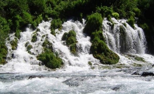
The Upper McCloud River's Big Springs
Mt. Shasta’s many springs are critical to California’s water supply
Mount Shasta is a stratovolcano located in the heart of the Klamath-Cascade Region in far northern California (about 50 miles south of the Oregon border).
Its sizable snowpack and glacial meltwater percolate through its porous volcanic geology, eventually emerging as hundreds of springs which feed cold, clear water into the Shasta River, the McCloud River and the Upper Sacramento River.
Mount Shasta’s cold, clean spring waters also feed critical municipal water supplies for the towns of Weed, Mount Shasta, Dunsmuir and McCloud. And provides critical inflow into Shasta Reservoir, which is vital to the state’s agricultural, hydropower, municipal and industrial water supplies.
Despite their obvious importance, no comprehensive study of Mount Shasta’s unique spring resources has ever been created.
In 2007, California Trout convened a group of scientists to design an initial baseline study of Mount Shasta springs — data which is badly needed to help make policy decisions based on the best available data.
Here are the results of that study:
- The 2009 Mount Shasta Springs Summary Report (A little technical: 4MB .pdf file)
- The Mount Shasta Springs Booklet (a booklet aimed at the layman: 13MB .pdf file)
- The Mount Shasta Springs Booklet (as above, but in online “flipbook” form)
- Map of Springs Near Mt. Shasta (Big File Warning: 62MB .pdf file)
- Mt. Shasta Springs Vulnerability Rating (How vulnerable are specific springs? 360K .pdf file)
Details Of The Mt. Shasta Springs Study
The scope of the Mount Shasta Springs study included taking water samples from 22 springs on Mt. Shasta. Springs at high, middle, and low elevations, as well as springs located in each of the three watersheds (Shasta, Upper Sacramento and McCloud) were sampled. The water samples were analyzed for a full suite of general water quality and geochemical parameters. A subset of the samples was also analyzed for oxygen and hydrogen isotopes.
Five of the spring samples were age dated based on analysis of the tritium isotope. The purpose of the sampling was to determine the elevation that spring water originates on the mountain, as well as if any of the springs may be related. The flow of nine springs was monitored quarterly to determine if there are seasonal and/or yearly fluctuations. After the first year the study was refined and the 2009 report summarizes and analyzes the first two years of data.
The information collected from the study informed the development of a vulnerability rating for the springs sampled. The rating analysis assumed that Mount Shasta spring waters could be vulnerable to land use (water quality), development (water use), and climate change (variability). The purpose of the vulnerability rating is to assist with water management decisions.


 Dams block access to historical spawning and rearing habitats. Downstream, dams alter the timing, frequency, duration, magnitude, and rate of change of flows decreasing habitat quality and survival.


 Human use of streams, lakes, and surrounding watersheds for recreation has greatly increased with population expansion. Boating, swimming, angling, off-road vehicles, ski resorts, golf courses and other activities or land uses can negatively impact salmonid populations and their habitats. The impacts are generally minor; however, concentration of multiple activities in one region or time of year may have cumulative impacts.


