Excerpted from Shasta’s Headwaters
Sometimes when you lose a piece of nature fundamental to your life, it happens quickly, like the metam sodium spill on California’s upper Sacramento River. One evening the river was full of trout, the next morning every last one of them was dead. Other times, a collapse in nature is insidious, a “death by a thousand cuts” as the old saying goes.
A third falls somewhere in between. In this case: the McCloud River. Fabled and iconic both for its beauty and superb fishery it emerges from the flanks of mystic and cosmic Mount Shasta, shaded by old growth conifers. For the many of us who have traipsed up and down its banks over the centuries, it has often been described as ‘our church.’
From the Winnemem Wintu Tribe who have lived along the river since time immemorial, to newly flush immigrants created by California’s gold rush during the 1850’s and rainbow trout exported worldwide, even the name ‘McCloud’ conjures up an ideal trout stream brimming with cold, nearly glacial water.
I was sadly prescient in my book “Shasta’s Headwaters” when I commented on the geology framing the McCloud River and its social history. During 1875, a civil engineer reported he had observed a peculiar broad flow of mud fanning out over a flat, originating, it seemed, from a deep gash high on the southeast flank of Mount Shasta. The flow of mud had been overgrown by vegetation and only someone with time on their hands would have noted it. No one took much note of his report, it appears, for about fifty more years.
During that time, much had changed in the area adjacent to the flow. Thousands of acres of forest had been bought, a large mill and railroad constructed, and the town of McCloud established. The muddy stream which washed off the mountain had by now, of course, been named Mud Creek.
Mount Shasta, towering 10,000 feet above its surroundings and encompassing a volume of roughly eighty cubic miles, is the Cascade range’s largest stratovolcano. Gouged 1500 feet in its side, Mud Creek Canyon, by one definition, is the mountain’s deepest. Perched above is the aptly named Konwakiton Glacier. In Wintu language, even the name translates to ‘mud,’ and it had been experiencing changes. The glaciers on the mountain have been rapidly shrinking. In 1895, Professor Dillar of the U.S. Geological Survey estimated the length of the Konwakiton Glacier at approximately five miles. Edward Stuhl, an early mountaineer and chronicler of the mountain, gauged that in 1924 alone the glacier had receded three-eighths of a mile. At last measure, it is less than a few hundred yards long, and extreme snow and ice-melt from the snout of the glacier drop straight into the cleft of Mud Creek Canyon.
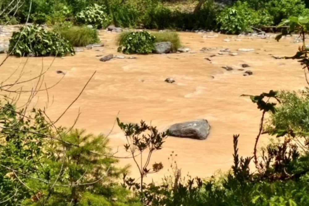
Silt turns the McCloud River a chocolate milk color
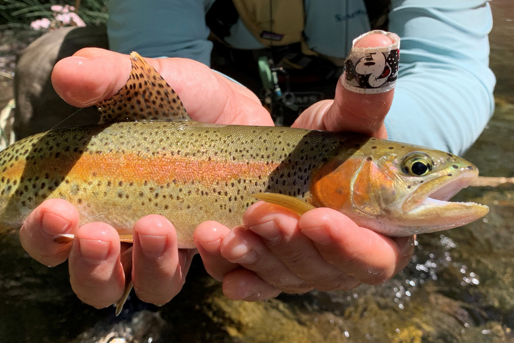
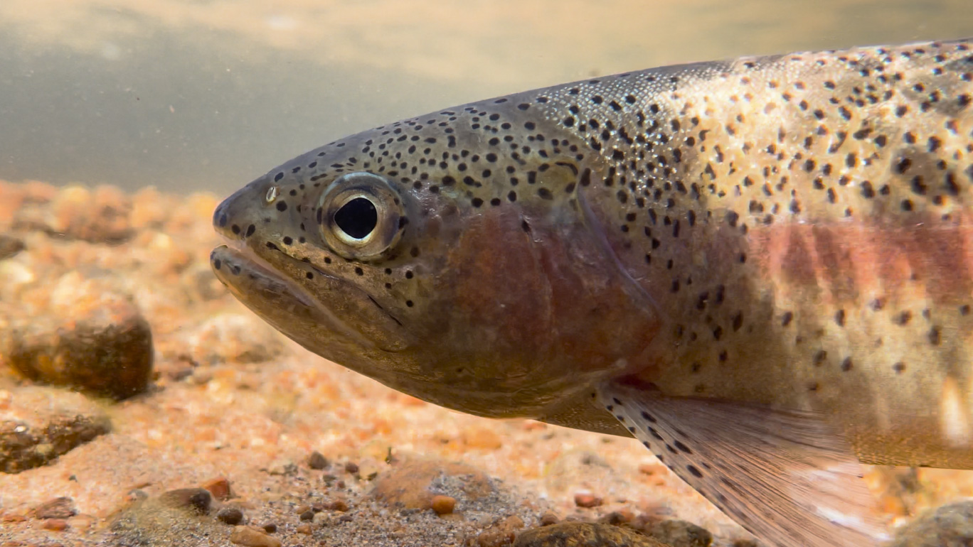
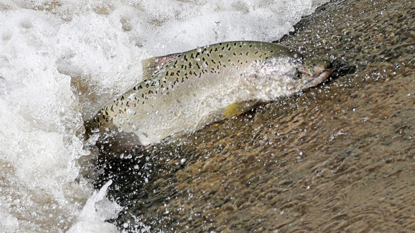
An iconic McCloud River rainbow trout
During the summer of 1924, vast discharges of mud began to gush down the canyon, sweeping over the flat, flowing through the forest and manzanita at the edge of town, finding their way into the McCloud River. While it remains unclear how many yards ran down into the river, we do know it was enough to muddy even the waters of San Francisco Bay where freshwater blends with the saltwater of the Pacific Ocean, nearly three hundred miles away. This seasonal event was repeated in subsequent years.
The press, of course, followed the mud. The flow not only brought muddy ash, but deposited boulders several tons in weight, measured between two and nine feet deep, and in some places, nearly a mile in width. One reporter noted, “When one drives out on a road a foot or so deep with powdery, billowy dust, through ‘cut over’ land that’s dry as a bone and sees a woman a few feet ahead raising her arms frantically and starts sinking out of sight through what appears to be solid ground, it makes one blink.” (Stockton Record 9/6/24. “Boulders Float Like Feathers on Mud Stream)
The seasons passed, and although the now annual summer mud flow fluctuated depending on the snowpack and summer temperatures, prevailing conditions persisted. It was reported that: “Property owners in McCloud have been working for ten years to get State or Federal aid to help control the mud that has ruined the McCloud River as a fishing stream.” (Mount Shasta Herald, 5/11/33). During the following decades, the largest trout taken out of the lower river were from tributaries. By 1936, State funding for a diversion dam was allocated, as The Herald further describes, “to protect (among other items), propagation of salmon in the McCloud River…the U.S. Hatchery at Baird can operate efficiently since the silt will no longer cloud the river and destroy fish life in the spawning ground.” The diversion dam worked, though the sizes of trout reported at the McCloud River Club revealed smaller catches for over a decade following.
The extreme heat experienced in the region during the past few years has unfortunately brought the mud flows back, filling the river with silt and often reducing the McCloud to unfishable status yet again. No photo I have seen, since cameras have been lugged to the mountain for well over a century, have depicted our mountain so bereft of snow as during the current crisis. Not even the heavy snowfall of this past 2022-23 winter have quelled the mud. While other man-made factors including the PG&E McCloud Dam contribute, the unsettling fact remains: visitors have all but vanished at the Nature Conservancy’s Preserve and the future of our beloved fishery remains uncertain.