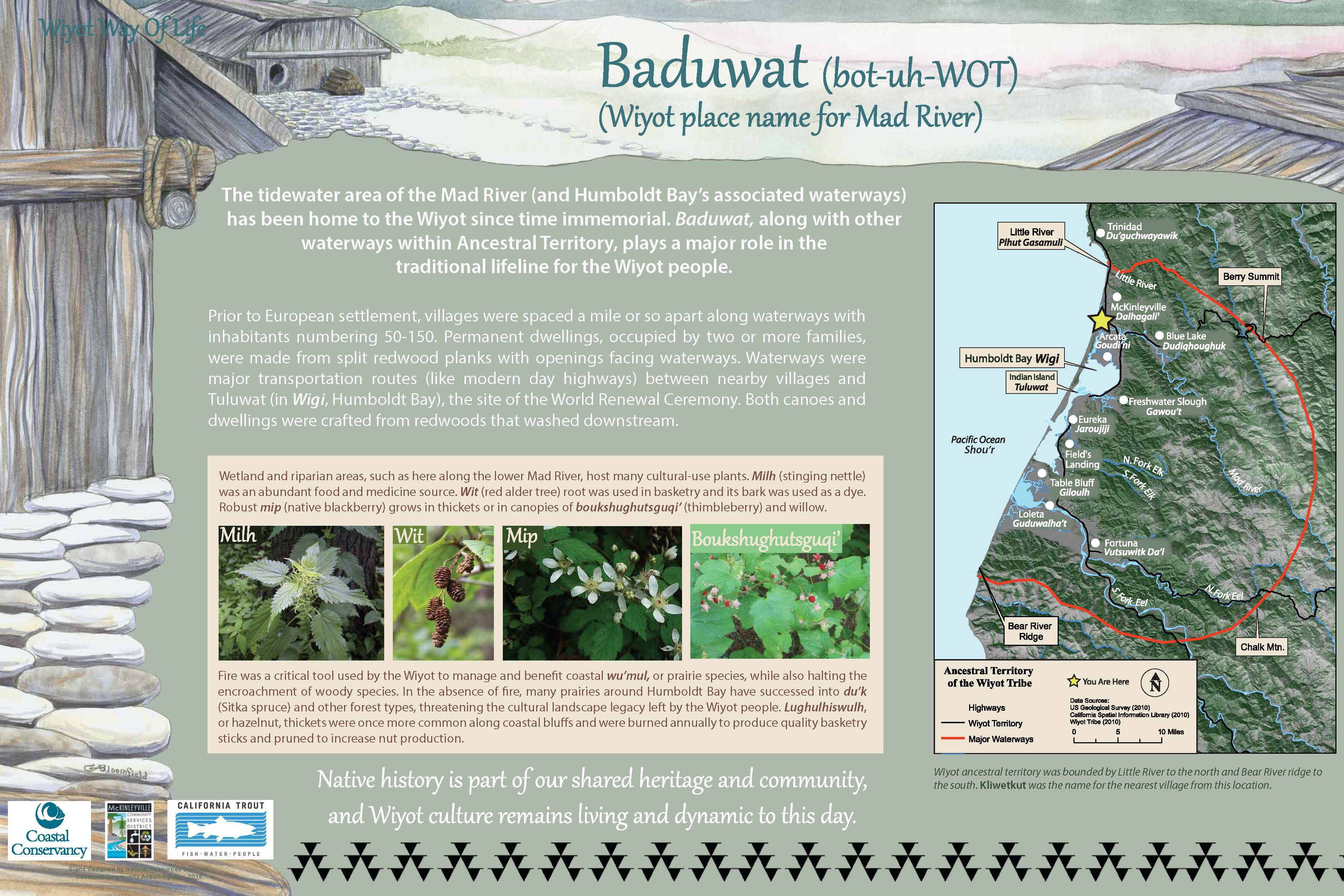
The Baduwa’t is a life source for the communities it flows through and has been since time immemorial.
The river, also known as the Mad River, is the source of drinking water for local communities and is crossed daily by people commuting on Highway 101 and 299. This 500 square mile river system is an entire world for the fish, invertebrates, and wildlife that depend upon the quality of the water and habitat.
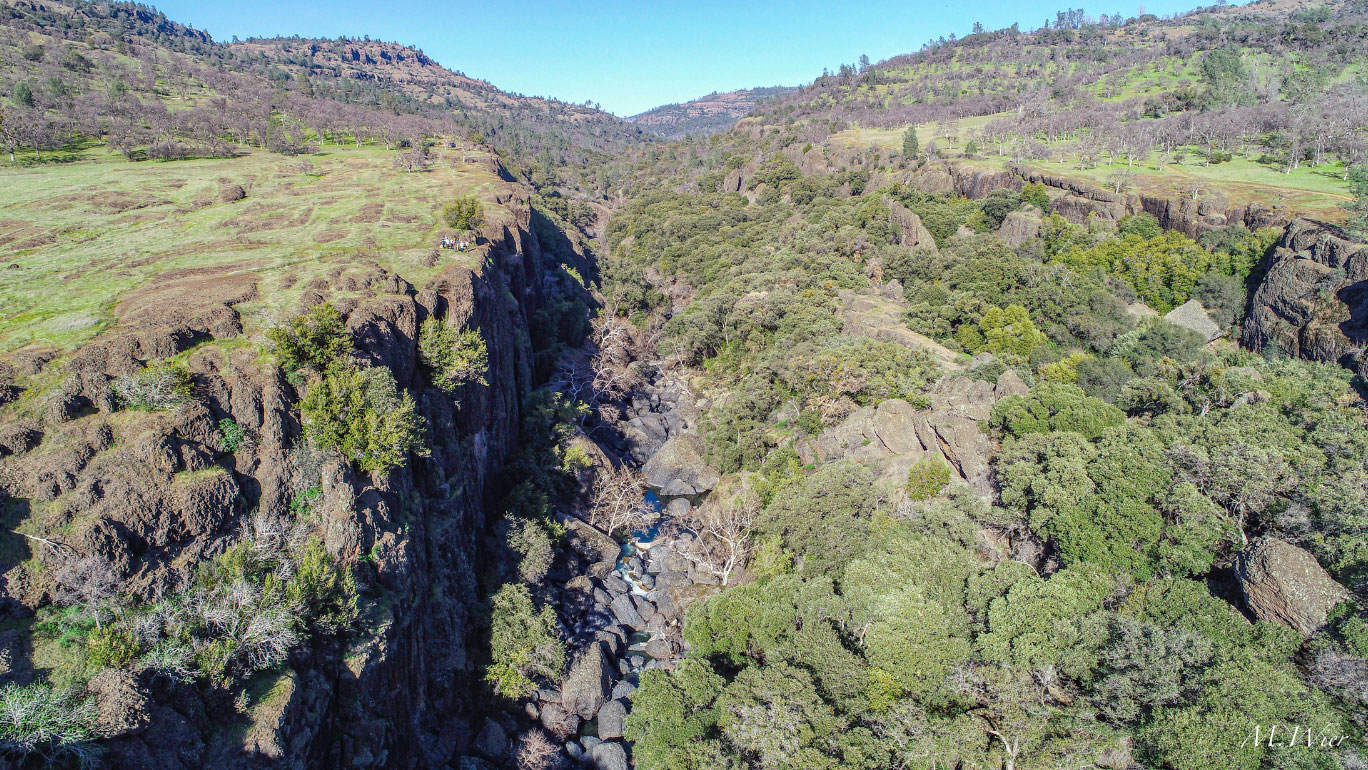
At the close of 2022, the construction of the backwater pond, channel and public access amenities are substantially complete. Three miles from the mouth of the river, the Baduwa’t and tides now carry lightly salty water, fish, and aquatic invertebrates in and out of a newly constructed 1,000 foot channel and a 4-acre complex of riparian wetlands with a large pond. Native plants were planted by California Conservation Corps crews in November and December and are wintering, waiting for a warm day in the spring to spread out new leaves.
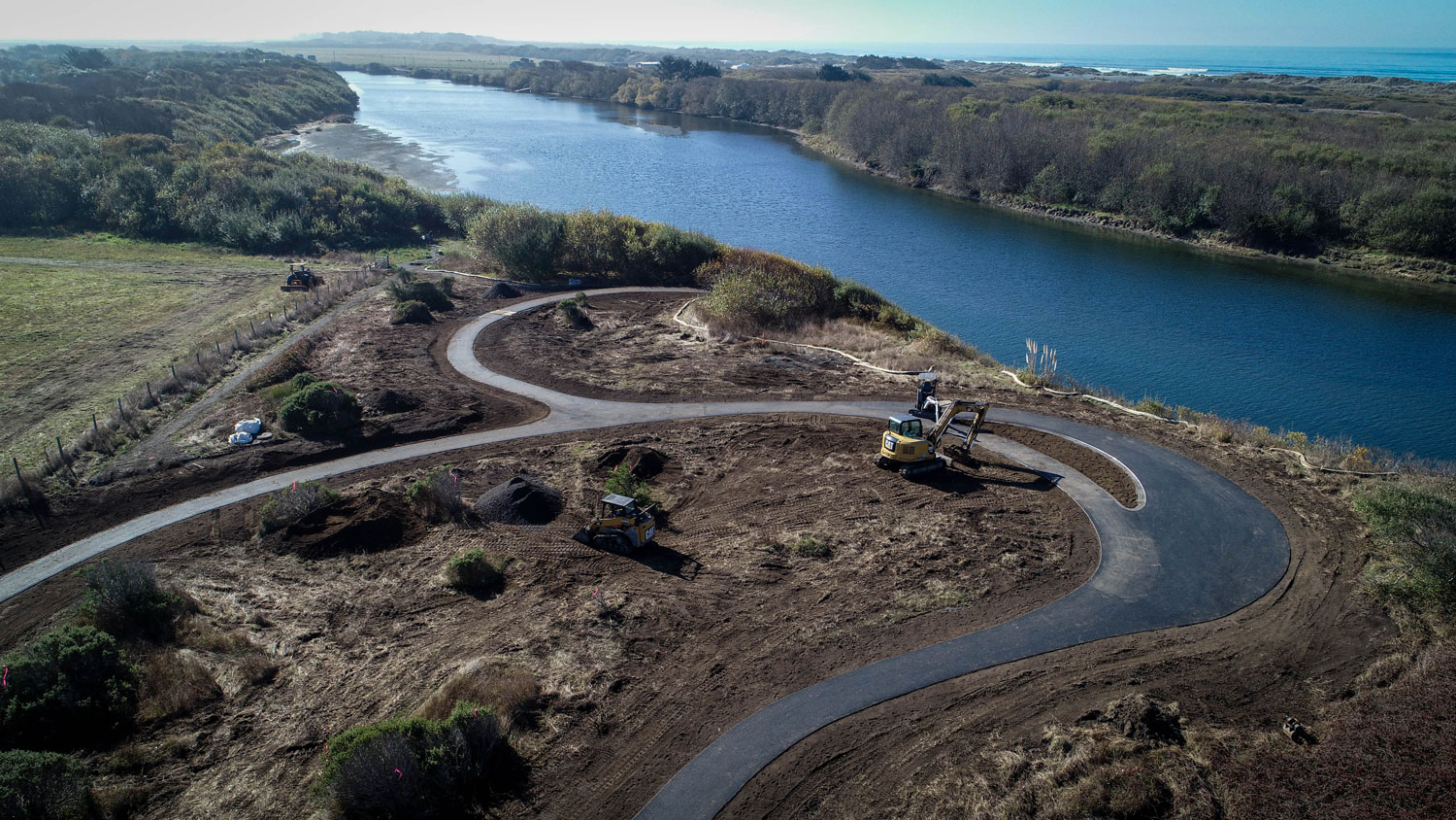
Photo by Mike Wier.
On the bluff overlooking the river, the new public access is open to all visitors and offers inspiring coastal view as the Baduwa’t bends towards the vast Pacific Ocean. The site has a fully ADA accessible small loop trail and two overlooks with seating and a picnic table at a location that is walkable and easily accessible by bike, as it is adjacent to the southern edge of McKinleyville. In the coming months, with expertise from RCAA and in partnership with the Wiyot Tribe and McKinleyville Community Services District (MCSD), interpretive signage will be installed.
Historically the estuary of the Baduwa’t was linked to a broad floodplain which provided critical habitat for juvenile fish including coho, steelhead, and Chinook as well as eulachon, smelt, and lamprey. Young salmonids use this gentle brackish habitat to rest and grow before their migration into the open ocean. Since time immemorial, the Baduwa’t has been central to the well-being of fish, wildlife, and Wiyot people (Elsasser 1978; cited in Roscoe and Assoc. 2018). The rich diversity of plants was stewarded, and harvested along with salmon, steelhead, lamprey, and candlefish. These resources provided the foundation of cultural wellness through trade and sustenance. Since Euro-American settlement, this historic floodplain has been manipulated to support flood control and agriculture and eliminated most off-channel habitat to support juvenile fish during high flows in the winter and as they make their way out to sea. This project is improving the habitat as well as offering the opportunity for people to relate to the land and each other.
We built new relationships with the community as the project progressed. The opportunity to create new habitat and a new site for public access was championed by the landowner, McKinleyville Community Services District (MCSD), who provides services to the community of McKinleyville for water, wastewater treatment, open space, and recreation. When MCSD decided to stop using percolation ponds for treated wastewater disposal, the area occupied by these ponds became available to restore to floodplain connectivity and the bluff above the habitat project offers a universally accessible coastal viewpoint. The new ADA trails were added to MCSD’s gravel wildland interface with a large-rock staircase that provides river-level access.
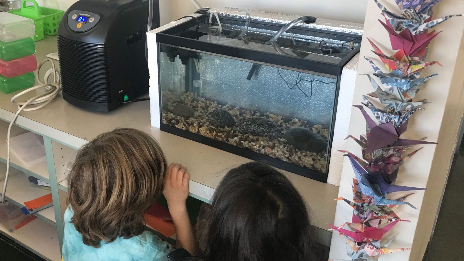
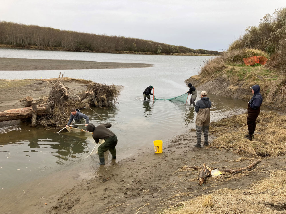
Additionally, as the project developed, so did the opportunity to learn from the Wiyot Tribe staff and Wiyot peoples through engagement on interpretive signage content including use of the endemic language, native vegetation, and discussions of what longer term partnership activities could be at this special location. In 2023, new efforts to monitor and learn from the site will begin, including fisheries monitoring and stewardship activities to care for and manage the new native plants. As we look to the future, we are excited to plan for long-term management and watch as the new habitat and public access features adapt to become a part of the local ecology.
The Baduwa’t waters flow through us and the landscape; and it swirls around mammals, fish, into the plants and then into the air that we breathe playing a central role in life on the North Coast.
CalTrout is honored to use our skills, experience, and enthusiasm alongside land managers such as MCSD and Wiyot people, who are the stewards since time immemorial.
We are deeply appreciative of our team of consultants and local partners at Northern Hydrology and Engineering, GHD, Trinity Associates, McBain Associates, SHN, John Northmore Roberts and Associates, Mr. Turner a local trail expert, Ms. Kalt a local botanist, Samara Restoration, the CA CCC and the Redwood Community Action Agency, Cal Poly Humboldt, for their dedication to the success of the project. Thank you to Kernan Construction and Miller Farms, local contractors whose teams moved the earth and installed the new access amenities. We are grateful to work with funding and resource agency partners including the California State Coastal Conservancy, Conservation Corps, Wildlife Conservation Board, and Department of Fish and Wildlife; and Federal partners at NOAA Fisheries and Restoration Center, and US Fish and Wildlife Service, and Humboldt County, as well as funding from the CA Alternatives to Toxics, Foundations, and generous members and donors alike.
Together we build the future we value and depend upon.
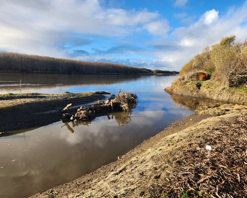
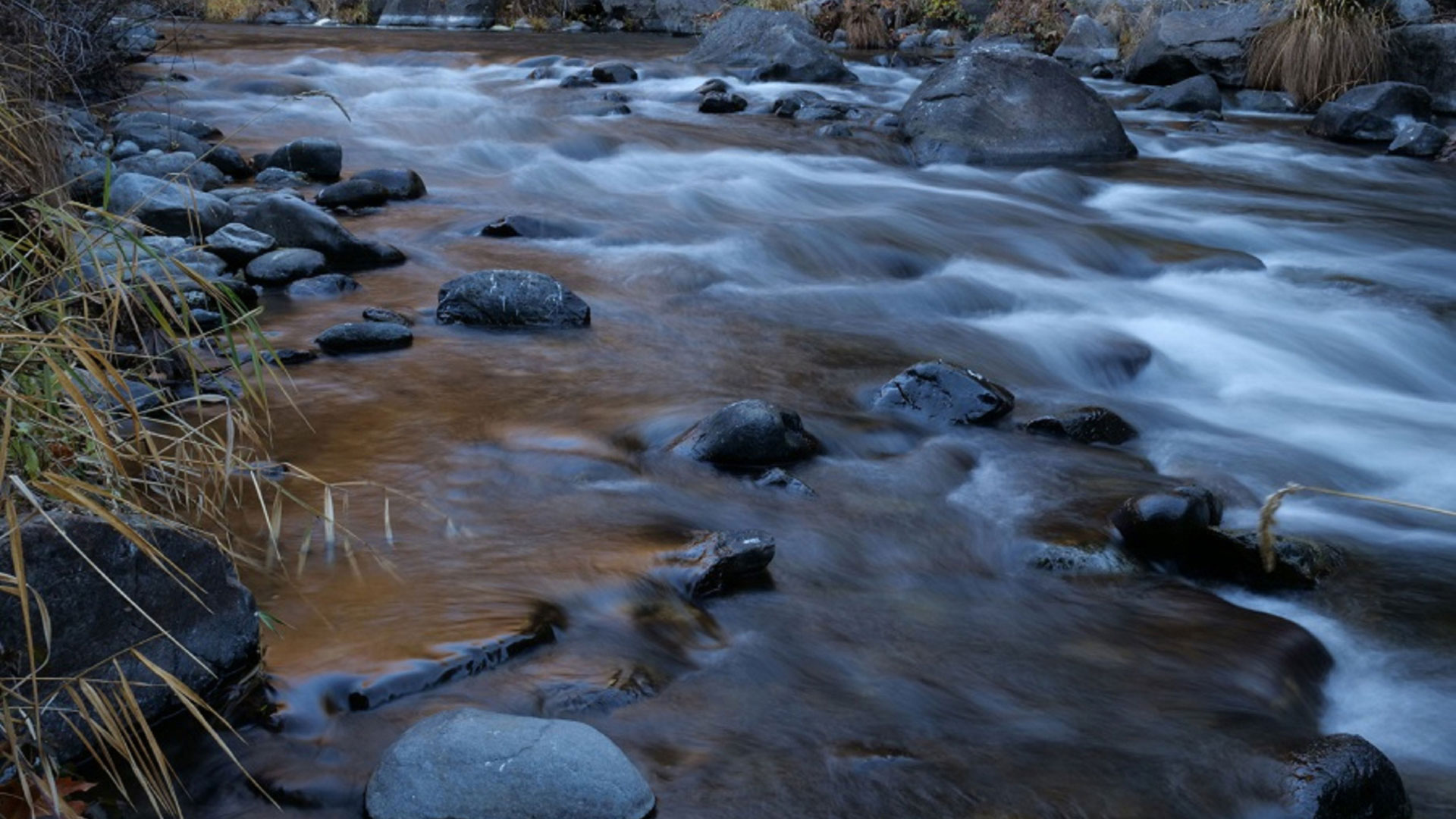
Photo by Katy Gurin.
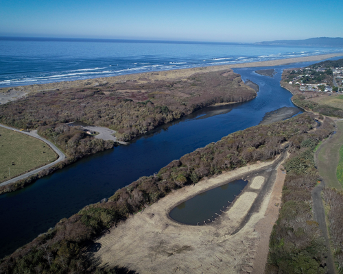
Photo by Mike Wier.